Download free versions of various Hong Kong MTR maps below for your travels!
Using Hong Kong’s public transportation doesn’t have to be scary! In my experience, it’s one of the cleanest and easiest to navigate in all of China. Before you brave Hong Kong’s public transportation, though, you’ll want to have some good Hong Kong MTR maps downloaded or printed. Browse the various maps below and download the one(s) that work best for your needs.

There are two ways that you can download the maps:
- Right click on the image and click “Save Image As”
- For a higher quality, PDF printable map, click the buttons below the map to download.
If you’d rather, you can also click here to download all the maps on this page as a single PDF.
Hong Kong MTR Maps
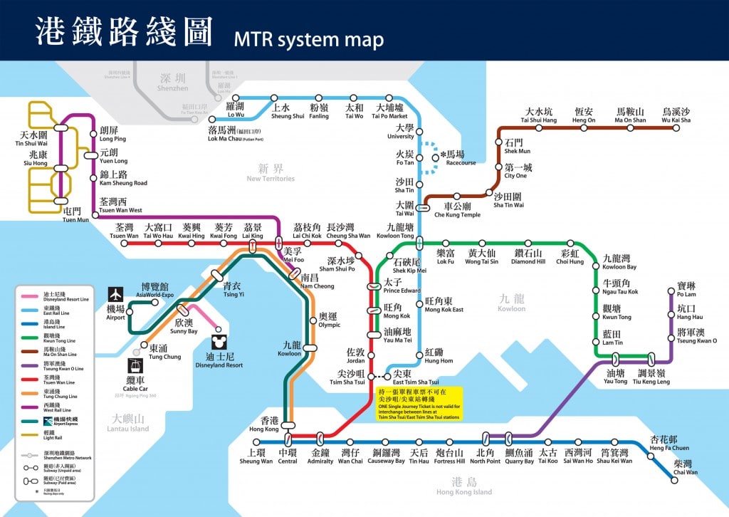
Click here for a printable PDF version of the Hong Kong MRT map:
Download Hong Kong MTR Map PDF
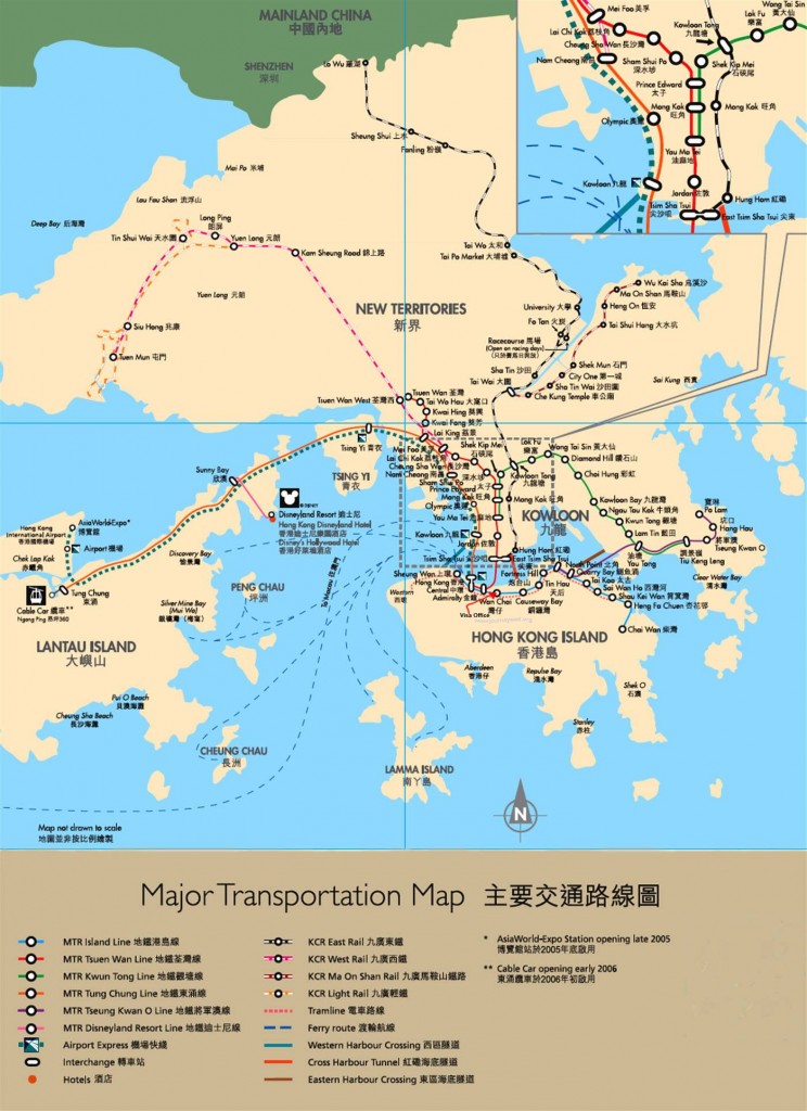
Click here for a printable PDF version of the Hong Kong Major Transportation map:
Download Hong Kong Transportation Map PDF
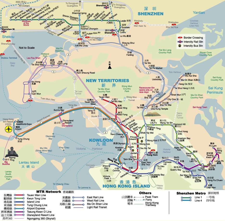
Click here for a printable PDF version of the Hong Kong MTR Tourist map:
Download Hong Kong MTR Tourist Map PDF
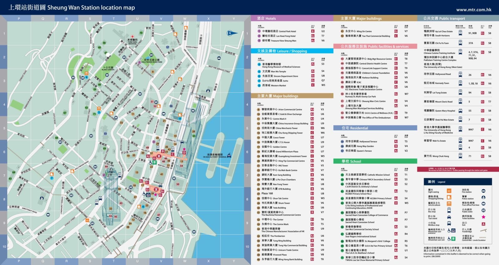
Need more detail? Click here for HK and Kowloon MTR station area maps showing major attractions, buildings, hotels, shopping, etc.
Hong Kong LIGHT RAIL Route Map
In addition to the subway, Hong Kong also boasts a nice light rail transit system (LRT). It’s not nearly as far-reaching as the Hong Kong metro system, covering only the New Territories area.
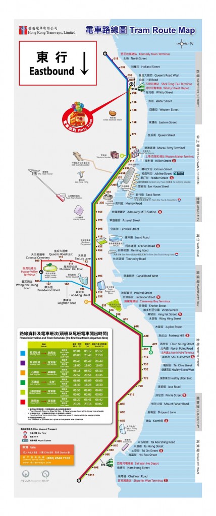
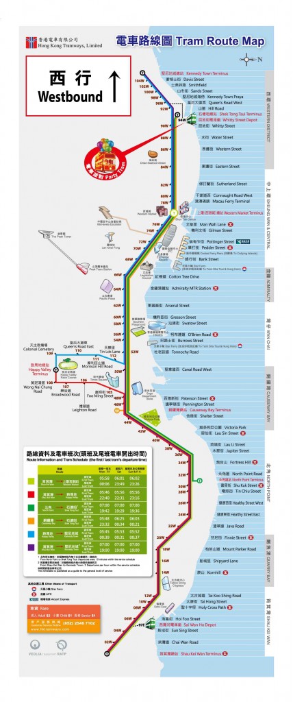
Hong Kong Tramway Map
Finally, the Hong Kong Tramway is a public transport system that only covers the northern border of Hong Kong Island, traveling east-west. The stops are different based on whether you’re east-bound or west-bound, so both have been included below.
Click here for a printable PDF version of the Hong Kong Tram map:
Download Hong Kong Tram Map PDF
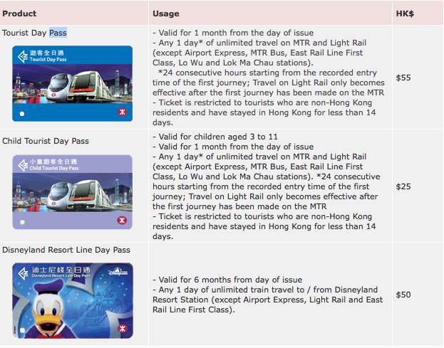
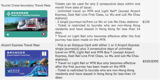
Special TOURIST MTR Cards
Thankfully, Hong Kong offers a number of options to make public transportation much easier. These cards can be bought at any MTR station in Hong Kong.
Return to China Travel Maps


