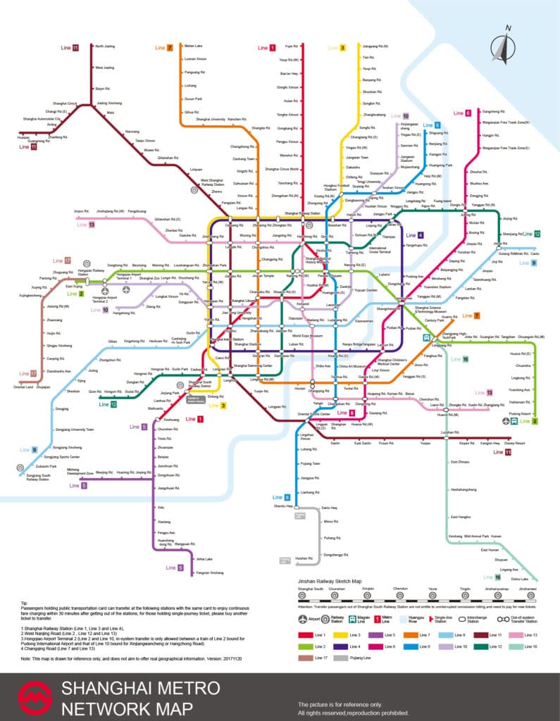
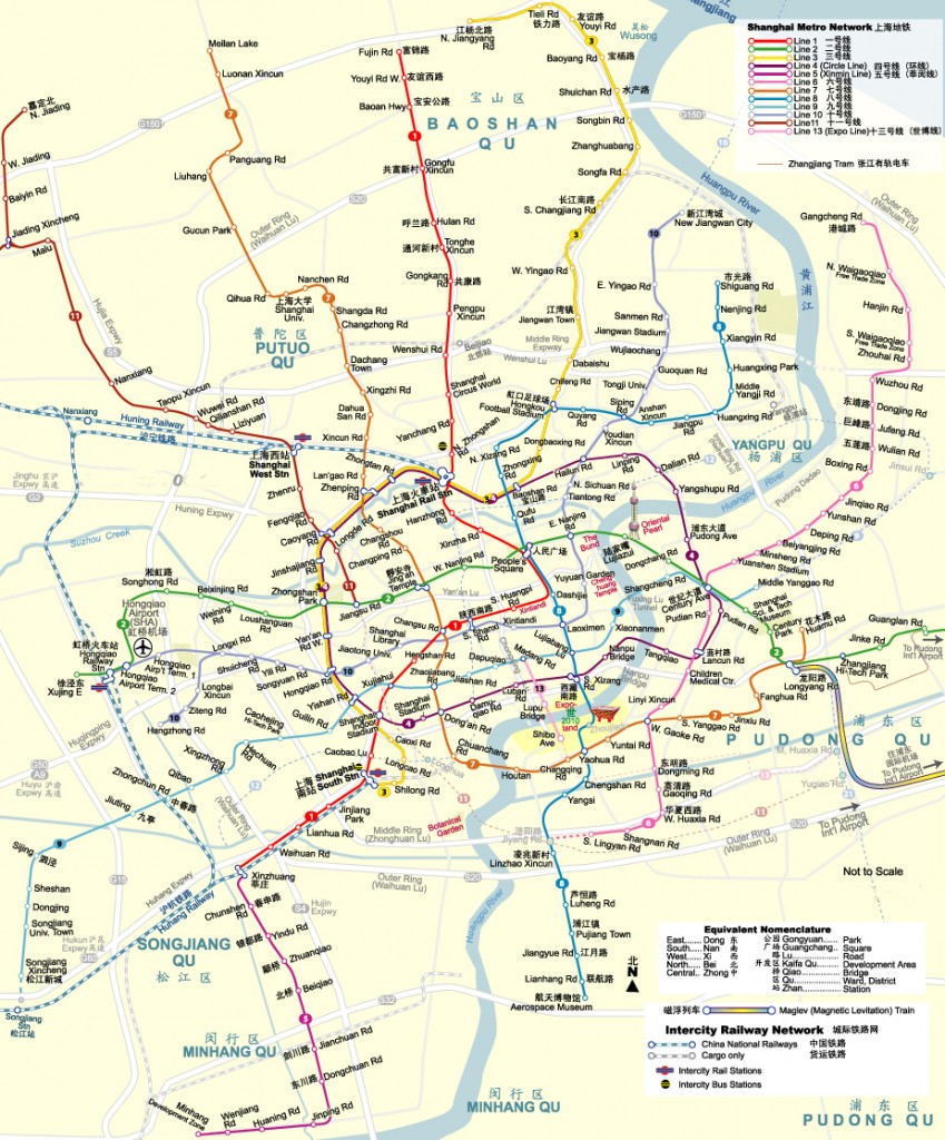
Use this printable Shanghai Metro Map to navigate the complex system of subways when you visit the city!
Below are a few helpful subway maps you can use to either save to your device or print off.
In either case, you’ll want to click the image below to get the full-size image, and then either save or print based on your preferences.
Enjoy and while you’re planning your trip, be sure to check out what to do in Shanghai as well as the nearby tourist town of Suzhou.
Shanghai Metro Map
One thing you’ll notice as you look at the Shanghai metro map is how complex it is. The city is so large, there are a crazy number of subway lines!
Don’t be afraid. You’ll only end up using a few of these metro lines.
And in some cases, it’s probably better to use your phone in China to access maps to give you directions.
The Shanghai Subway Map above shows the most up-to-date subway lines in the city (as of 2024), although this is constantly changing with new construction.
Thankfully, the city offers an official Shanghai metro website in English that you can visit to check for any changes that have happened.
Tips for Visiting Shanghai, China
As you can tell from this Shanghai metro map, Shanghai is a HUGE city.
Much larger than you’ll be able to cover in a single trip, trust me.
It pays to prepare well for your trip to make sure you hit all the sites that you want to see in the amount of time you’ve given yourself.
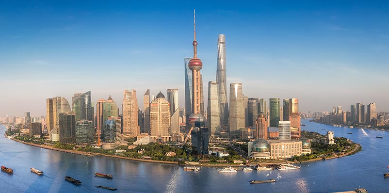
- Do you want to visit the Bund?
- Do you want to see from the top of China’s tallest building?
- Do you want to explore Shanghai Disney?
The best thing you can do to prepare is to purchase a good Shanghai travel guide book and then do your research to know what you want to do.
I’ve included a list of some China Mike recommendations below.
Enjoy your trip and I hope this Shanghai Metro Map was useful!


